

Do You Really Need GCPs for Aerial Mapping? A Complete Guide
Aerial mapping has become one of the most powerful tools for surveying, construction, agriculture, mining, and environmental monitoring. Drones can capture hundreds of high-resolution images in minutes, but turning that imagery into accurate, reliable maps still requires more than just advanced hardware.
This is where GCPs for Aerial Mapping come into play. They anchor your aerial data to real-world coordinates, dramatically improving accuracy and consistency. But do you really need them for every project? This guide breaks it down.
What Are GCPs in Aerial Mapping?
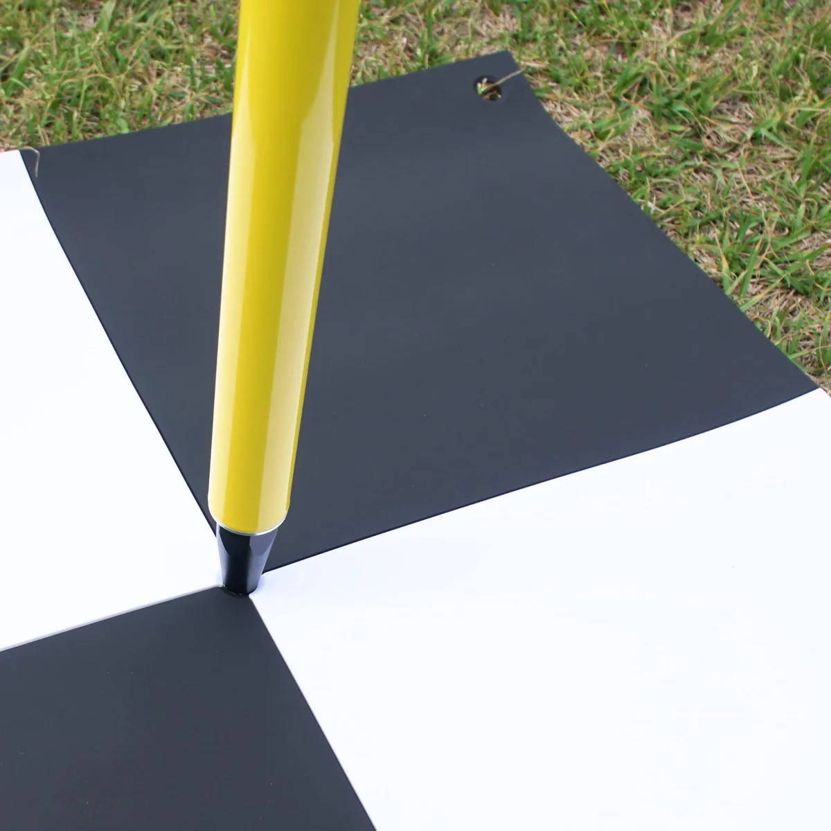
Ground Control Points (GCPs) are physical markers placed on the ground with precisely measured coordinates. These markers are easily visible in drone imagery, allowing mapping software to align and correct the dataset.
How They Work
-
A surveyor records their exact GPS/GNSS position.
-
The drone captures images that include those markers.
-
Processing software matches the known coordinates to the aerial photos.
-
It adjusts the entire map to eliminate distortions and improve accuracy.
In short, GCPs act like anchor points that connect your aerial data to real-world spatial accuracy.
Do You Always Need GCPs?
The short answer: not always but for professional mapping, they’re often essential.
Whether you need them depends on:
-
Required accuracy level
-
Type of drone used (RTK/PPK vs. non-RTK)
-
Project complexity
-
Site conditions
-
Legal or industry standards
Let’s explore these factors in depth.
When GCPs Are Essential
1. Projects Requiring Centimeter-Level Accuracy
If your mapping work involves surveying, construction layout, engineering, or legal boundaries, even a few inches of error can cause major problems.
LSI keywords such as survey control markers and geospatial reference points become crucial here.
Examples
-
Road and bridge design
-
Stockpile measurements
-
Cut-and-fill analysis
-
Utility installation
-
Earthworks planning
Using GCPs ensures your deliverables meet professional accuracy standards.
2. Large or Complex Terrain
Complex landscapes such as quarries, forests, elevation changes, and uneven topography tend to cause image distortion during processing.
GCPs help the software maintain consistent scale and orientation.
3. Legal or Regulatory Compliance
In many civil engineering, mining, or environmental projects, accuracy must meet strict guidelines.
Without GCPs, your dataset may not pass verification or compliance checks.
When You May Not Need GCPs
1. Using RTK or PPK Drones for General Mapping
Modern RTK/PPK drones like DJI’s flagship survey models can produce high accuracy even without GCPs.
This is ideal for:
-
Agriculture field scans
-
Real estate mapping
-
Insurance documentation
-
Basic topographic surveys
While the accuracy won’t match a GCP-enhanced dataset, it’s often “good enough” for non-engineering use cases.
2. When Only Visual Outputs Matter
If your goal is to create:
-
Marketing images
-
Orthomosaics for visualization
-
Overviews of large properties
You can skip GCPs and still produce high-quality imagery.
3. Repeat Surveys Where Precision Is Not Critical
For monitoring site changes over time like vegetation growth or construction progress relative consistency may matter more than exact measurements.
How Many GCPs Do You Need?
The number depends on the size and complexity of the area. Here’s a helpful breakdown:
Recommended GCP Count
-
Small sites (1–10 acres): 4–6 points
-
Medium sites (10–50 acres): 6–10 points
-
Large sites (50–200 acres): 10–20 points
-
Very large areas: Place one GCP every 300–500 meters
Placement Tips
-
Distribute evenly across the project area
-
Place at least one near each corner
-
Add extra markers around elevation changes
-
Ensure clear visibility for the drone
Using too few can lead to distorted results. Using too many can slow down the workflow.
Benefits of Using GCPs
More Accurate Orthomosaics
When processing aerial imagery, GCPs reduce drift and scaling errors.
Better 3D Models
Accurate vertical alignment leads to more trustworthy 3D meshes, DEMs, and contour lines especially useful for excavation and earthwork analysis.
Improved Consistency Across Flights
LSI terms like reference markers help ensure multiple surveys align over weeks or months, improving long-term monitoring.
Fewer Revisions & Less Rework
Correcting errors during processing is far more expensive than placing GCPs upfront.
Are There Alternatives to GCPs?
RTK/PPK Technology
High-precision drones can reduce or replace the need for GCPs but they still benefit from at least one or two checkpoints.
Smart Targets
Reflective or coded targets can improve automation and reduce setup time.
Aerial Triangulation
While helpful, it’s rarely as accurate as physical ground markers.
Bottom line: alternatives can support your workflow, but they rarely fully replace GCPs for mission-critical mapping.
Final Verdict: Do You Really Need GCPs?
You should use Ground Control Points when:
-
Accuracy must be verified or legally valid
-
You’re surveying complex environments
-
You’re producing engineering-grade deliverables
-
Absolute accuracy is more important than speed
You can skip them when:
-
A project only needs approximations
-
You’re using RTK/PPK drones for quick scans
-
Visual outputs are the main goal
Most professional workflows still rely on GCPs to guarantee precision and trustworthiness.
Conclusion
Ground Control Points remain one of the most effective ways to enhance aerial mapping accuracy. Whether you’re working in construction, mining, land surveying, or environmental monitoring, they help bridge the gap between drone imagery and the real world.
Using them wisely ensures your maps, models, and measurements deliver reliable results every single time.